| Sign In | Join Free | My benadorassociates.com |
|
| Sign In | Join Free | My benadorassociates.com |
|
| Categories | Seismic Instruments |
|---|---|
| Brand Name: | GOLD |
| Model Number: | GD-3C |
| Certification: | CE, ISO |
| Place of Origin: | chongqing,China |
| MOQ: | 1 set |
| Price: | Negotiated |
| Payment Terms: | L/C,D/A,D/P,T/T,Western Union |
| Supply Ability: | 1 set per 5 days |
| Delivery Time: | 5-8 work days |
| Packaging Details: | wooden case |
| Use: | Nodal SeismographTriaxial Broadband Seismic Recorder Seismic Node |
| power: | Electronic |
| Bluetooth QC: | Available |
| Waterproof: | IP68 |
| Operating temperature: | -40℃ ~ +70℃ |
| ADC resolution: | 24 bits |
| Company Info. |
| Chongqing Gold Mechanical & Electrical Equipment Co.,Ltd |
| Verified Supplier |
| View Contact Details |
| Product List |
Building Urban Seismic Resilience Through Dense Sensor Networks
The GD-3C Nodal Seismometer enables comprehensive urban seismic monitoring through cost-effective deployment of dense sensor arrays that provide real-time ground motion data essential for emergency response, building code development, and infrastructure planning. This advanced monitoring system represents a fundamental component of modern smart city infrastructure, delivering the critical seismic intelligence necessary to protect urban populations and economic assets.
Urban Seismic Risk Assessment
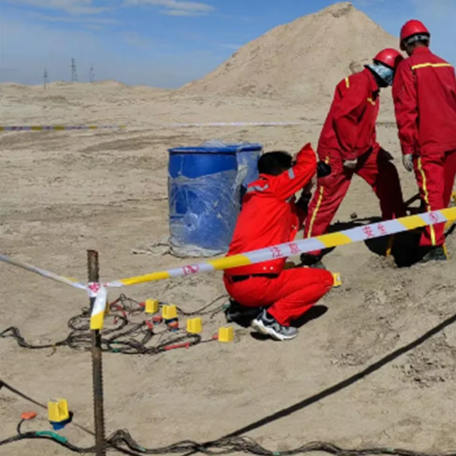
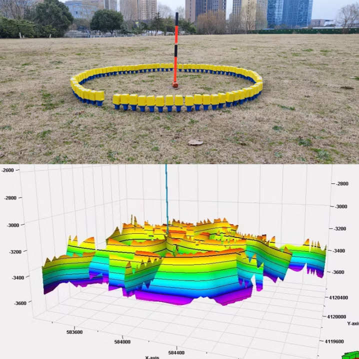
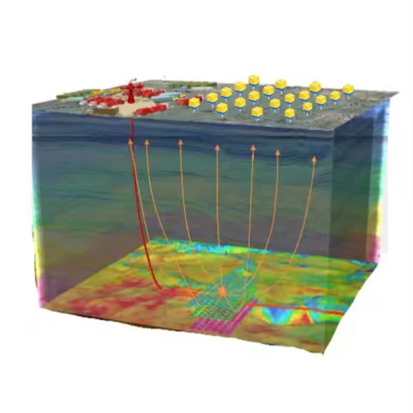
Modern urban environments face significant seismic risks that require detailed site characterization and continuous monitoring to inform emergency planning and building design. The GD-3C system facilitates microzonation studies that identify spatial variations in ground shaking potential, enabling targeted strengthening of vulnerable areas. The system's high-density deployment capability allows municipalities to establish urban seismic networks that capture localized amplification effects caused by subsurface geology and sediment thickness variations. This detailed ground motion data informs building code modifications and prioritization of retrofit programs for existing structures.
Emergency Response Coordination
When seismic events occur, the GD-3C network provides immediate shaking intensity data that guides emergency response efforts. The system's real-time data transmission enables rapid generation of shaking distribution maps that identify the most severely affected areas, allowing efficient deployment of first responders and resources. The integrated automatic alert system notifies emergency operations centers when predefined shaking thresholds are exceeded, triggering coordinated response protocols before manual reports are available. Post-event, the collected data supports detailed damage assessment through correlation of recorded ground motions with observed structural performance.
Urban Monitoring Specifications
| Parameter Category | Urban Deployment Specification | Municipal Application Benefit |
|---|---|---|
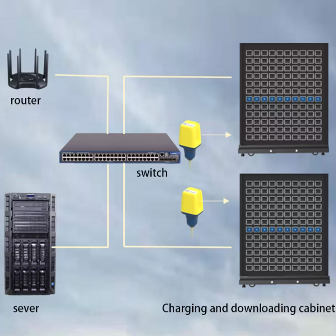
| Network Density | 500+ node capacity with centralized management | Enables city-wide monitoring with localized resolution |
| Data Latency | <5 seconds from detection to alert dissemination | Supports rapid emergency response coordination |
| Public Safety Integration | Standardized APIs for emergency management systems | Direct integration with public warning and response infrastructure |
| Installation Flexibility | Minimal infrastructure requirements with solar power option | Facilitates deployment in diverse urban environments |
| Data Accessibility | Web portal with public and administrative access levels | Supports both operational response and public information dissemination |
| Cybersecurity | Enterprise-grade encryption with intrusion detection | Protects critical infrastructure from cyber threats |
Long-Term Urban Planning Support
Beyond immediate emergency response, the GD-3C system provides valuable long-term data that informs urban development decisions and resilience planning. The accumulating record of ground motion observations allows municipalities to validate and refine seismic design parameters based on local response characteristics rather than generalized models. Urban development projects benefit from site-specific seismic hazard assessments derived from the network's recorded ground motions, enabling appropriate design for new construction. The long-term performance data supports cost-benefit analysis of seismic retrofit programs and helps prioritize infrastructure investments based on quantified risk reduction.

|
